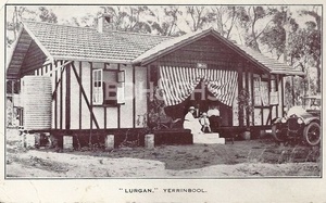
Discover Mount Lindsey
A rural locality in the Yerrinbool district, beside the Upper Nepean catchment.
Explore nearby and connected places: Yerrinbool · Avon · Aylmerton
Mount Lindsey through time
A rural locality beside the catchment
In the Yerrinbool district, Mount Lindsey is part of a landscape of scattered rural places and the Upper Nepean catchment. Its story is one of early attempts to farm the southern plateau and the homesteads that once stood there.[2][3][4]
Selections and clearings
The Upper Nepean State Conservation Area plan names Mount Lindsey among the places where agriculture was attempted in the early and mid-nineteenth century. It also records former homesteads at the first four places it lists, including Mount Lindsey. Later, in the 1950s, the water board’s forestry section propagated radiata pine for commercial production at Mount Lindsey. Land records, maps and local accounts can help reveal more about the people who worked this country.[4]
Name and boundary
The national Gazetteer records the present Mount Lindsey locality and the nearby landform as separate features. Together with Yerrinbool and Avon, the locality forms part of the district described in Wingecarribee Council’s community facilities strategy.[2][3]
Explore the Society’s photographs for sale
Explore the newsletters
Search newsletter contents for Mount Lindsey. You can also try nearby places, former names and other spellings.
Further research
There is more to discover about Mount Lindsey in the Society’s archives and in other collections. A catalogue entry may lead to material that has not been digitised or needs to be consulted in person.
- Ask the Society’s research centre about local files, photographs and records.
- State Library of NSW collections - search photographs, maps, manuscripts and local publications.
- NSW Historical Land Records Viewer - search historical land records, plans and parish maps by place or parcel.
Sources already connected with this place include:
The Society can undertake professional research at $40 per hour. Contact the research centre to discuss your question and request a quote.