Discover Colo Vale
Colo Vale’s former loop railway and village streets open a story of changing transport, local families and the names left on the map.
The 2021 Census counted 1,775 people in the ABS suburb and locality of Colo Vale.[18]

Explore nearby and connected places: Mittagong · Hill Top · Aylmerton · Balmoral
Colo Vale through time
Land, railway and an early village
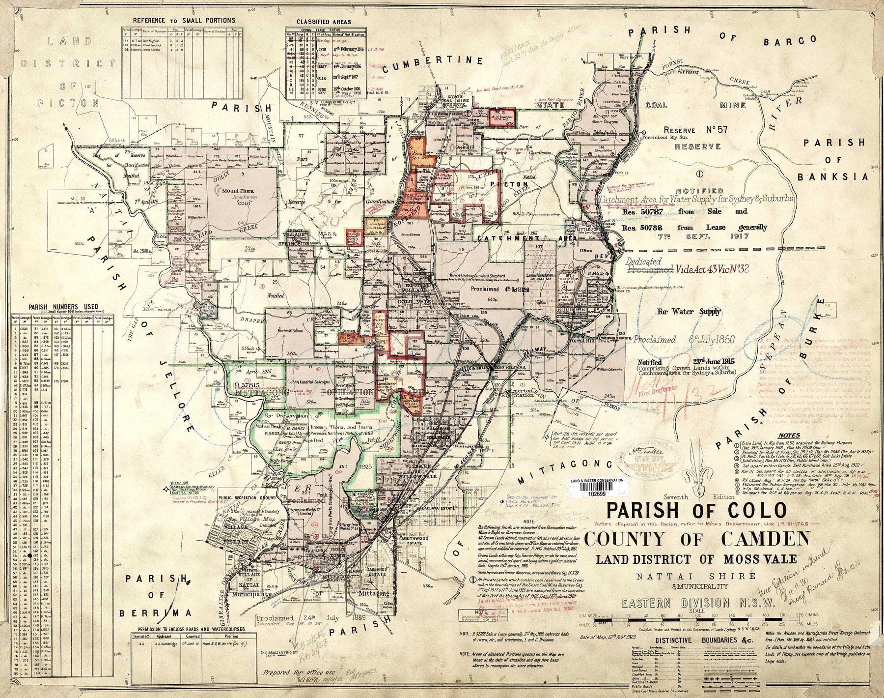
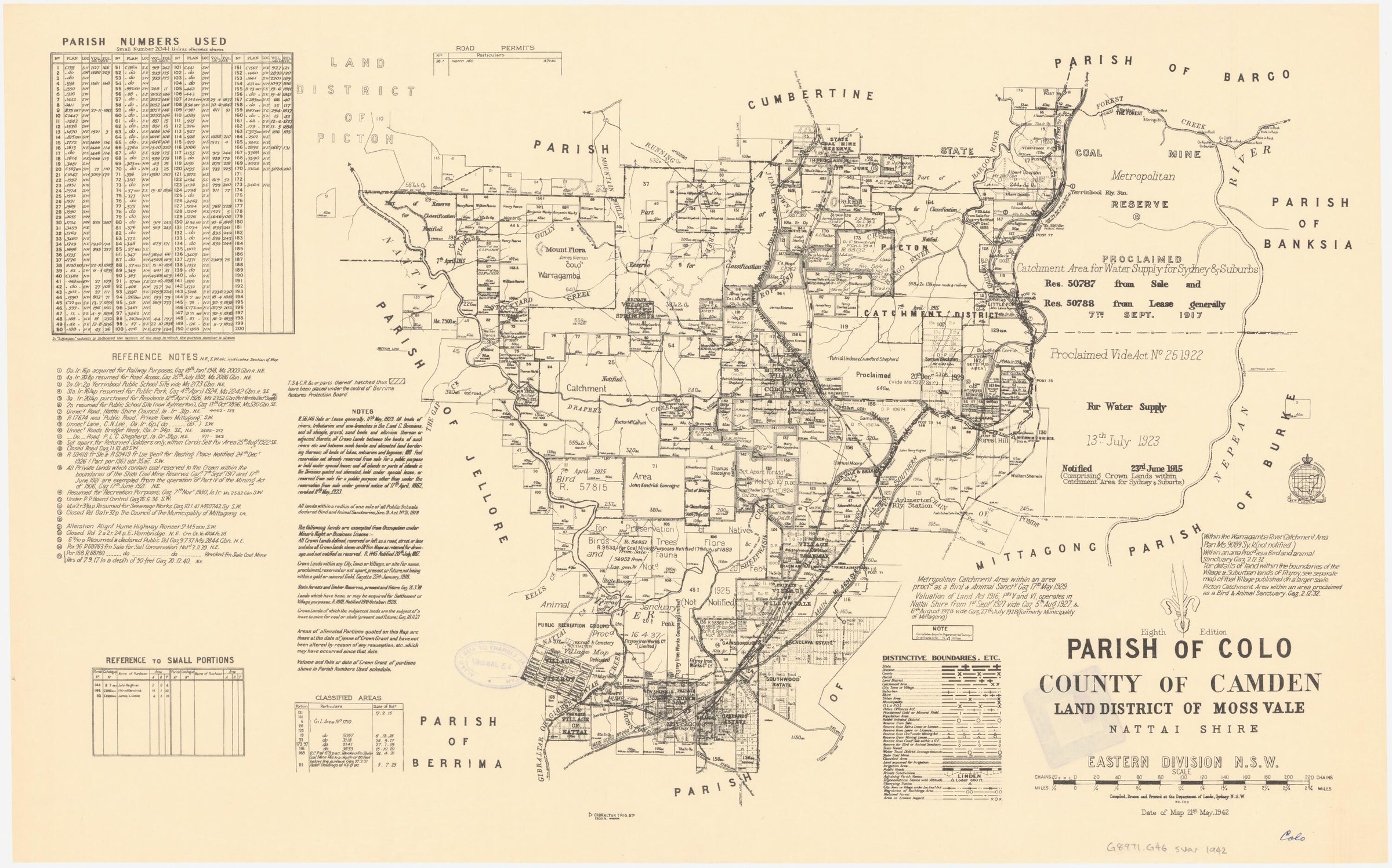
Chalker’s account connects the village layout to Patrick Lindesay Crawford Shepherd’s land in the Parish of Colo. She states that of 1,350 acres he acquired, 670 acres were subdivided and auctioned as the village, while 680 acres remained agricultural land later known as Wensleydale. Her article includes a map of his holdings and cites land-title records. The acreage and sequence are a starting point for checking the original parish maps, auction notices and individual title records.[10]
The village had earlier roots. Council’s history records that James Kiernan bought land called Colo in 1837, and that Colo Vale was offered for sale in March 1889. By then the small settlement had a store and a butcher’s shop. Parish maps, sale notices and titles offer ways to follow the people and blocks behind that brief account.[17]
The Council heritage survey identifies the Picton/Mittagong Loop Line and old railway station as a heritage item at Colo Vale. Council’s geographic history explains that Colo Vale and Hill Top were bypassed by a new Main Southern Railway alignment in 1919; their later growth from the 1980s included commuters working in Sydney. That sequence gives the railway a dual role in the locality’s story: first a formative transport link, then a route superseded by deviation.[8][9]
The Alpine Estate near Colo Vale illustrates the practical demands of subdividing rural land. The Wollondilly Press reported the sale of five cultivation lots in 1906. In 1908 the Robertson Advocate described Nattai Shire councillors inspecting a road from the estate and deciding to clear part of it to give settlers access to the main road. The historic estate name needs to be located on the original plans before assigning individual blocks to today’s localities.[15][16]
Council’s heritage planning papers identify St Paul’s Anglican Church as built in 1884 and say a school was built in the village in 1911. They also record the arrival in 1923 of migrant poultry farmers, an opening for research into local work and family histories.[11]
Schools and the community
The Society’s school history traces the institution from Chalkerville Provisional School in 1882 to a building moved to the Great Southern Road and Colo Vale Road corner in 1894. A new classroom opened there in 1911; the school was renamed Aylmerton in 1930. The account says the school moved to Wattle Street in present-day Colo Vale in 1985 for the freeway bypass and resumed the Colo Vale name. The names therefore refer to different sites over time.[14]
A naming trap matters when searching education records: a Society article says the school later called Aylmerton Public School had previously been called Colo Vale School, and was renamed in 1930 to clarify its location. Check the location and dates of a record before assuming it concerns a school in today’s Colo Vale village.[12]
Marie Chalker’s study of Colo Vale street names offers a route into the locality’s history. Her 2013 article examines botanical names and connections with landholder and nursery proprietor Patrick Lindesay Crawford Shepherd, alongside the parish map. The suggested origins remain research leads to check against plans and council records.[10]
The old railway station has been a focus for local interest: a 2018 Society newsletter advertised a station open day during the village market. Railway photographs, timetables and local memories can add detail to this part of the story.[13]
Work in the village went beyond the railway and the poultry farms. Council records that men were earning a living from charcoal burning in 1923. Its historical table counted 149 people in 44 dwellings at Colo Vale in 1954, a snapshot of the community before its later residential growth.[17]
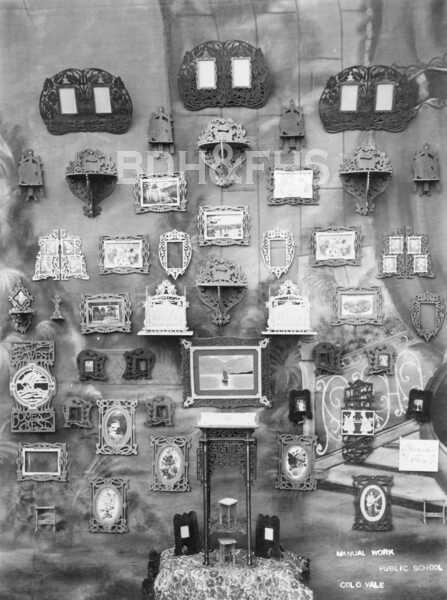
Browse local photographs linked to Colo Vale
Explore the Society’s photographs for sale
Browse maps and plans linked to Colo Vale
Newsletter Mentions
Stories about Colo Vale in the Society’s newsletters.
September 2013
- Marie Chalker researches Colo Vale street names, the Shepherd family and the village subdivision, with a map of Shepherd’s land and documentary references (pp.3-4).
Books in our Library
These catalogue titles mention Colo Vale. Check the linked catalogue and ask the Society about access.
- Arthur Cecil Cripps 8 Jan 1879 - 4 Sep 1934 - Colo Vale - catalogue p. 9
- Celebrating 50 years: Colo Vale Community Association Inc. A short history of the village and surrounding properties. (2000) - catalogue p. 16
- Colo Vale Community Centre 1961 - 2011. Book 3. (2011) - catalogue p. 18
- Memories of Colo Vale: Celebrating 125 Years 1883 - 2008 (2008) - catalogue p. 42
- St. Paul's Colo Vale Centenary 1884 - 1984 - catalogue p. 56
Find Society publications mentioning Colo Vale. The list is from October 2026; contact the Society about current availability.
Further research
There is more to discover about Colo Vale in the Society’s archives and in other collections. A catalogue entry may lead to material that has not been digitised or needs to be consulted in person.
- Ask the Society’s research centre about local files, photographs and records.
- State Library of NSW collections - search photographs, maps, manuscripts and local publications.
- NSW Historical Land Records Viewer - search historical land records, plans and parish maps by place or parcel.
Sources already connected with this place include:
- Wingecarribee Heritage Survey 2009
- Wingecarribee, Our Home
- Wingecarribee planning panel papers, May 2024: Colo Vale
- Wollondilly Press, 2 June 1906, p.2: Alpine Estate reported sale
The Society can undertake professional research at $40 per hour. Contact the research centre to discuss your question and request a quote.