An address can change and a house may stand on part of an earlier parcel. Start by fixing the property, locality and period you are actually researching.
Start exploring: Historical Land Records Viewer · Society maps and plans · Historic photographs · Visit the research centre
Make a start
Fix the address
Record street number, street, suburb/locality, parish if known, and earlier address forms.
Map the parcel
Use historic maps, plans and title material to identify the relevant land rather than assuming a modern address applies unchanged.
Separate owners and occupants
Create parallel timelines. A title can identify ownership; directories, rate books, electoral rolls and newspapers may help identify occupation.
Corroborate building dates
Compare plans, Council heritage information, newspapers, photographs and physical evidence. Do not infer construction from a later listing alone.
Keep a parcel timeline
For each source, record what land it describes, its date, reference number and the fact it actually supports. A plan can show a subdivision; it does not by itself prove a building date or continuous occupation.
The NSW Historical Land Records Viewer provides access to many historical maps, plans, titles, registers and indexes. Current title or deed searches are a different service and may carry fees.
Identify the land before chasing the address
Start with the current address and, if available, the lot and deposited plan number. Note neighbouring streets and landmarks, then look for earlier street names, renumbering and subdivision. Use NSW spatial maps and local council heritage information to orient the site; keep a copy or citation of each map with its date.
In the NSW Historical Land Records Viewer, search the relevant parish map and historical plans. Trace the land description and references to earlier and later titles or deeds. A historical plan shows the land as recorded at a particular time; compare boundaries carefully and remember that a modern lot may be only part of an older parcel. Current searches and copies can incur fees.
Build three timelines
For ownership, follow certificates of title, deeds and transfers in sequence, noting dates, parties, lot descriptions and references to prior documents. A transfer can identify a landholder without showing who lived there. Mortgages, subdivisions, probate and estate records may reveal more about changes in the property.
For occupants, compare rate and valuation records where available, directories, electoral rolls, newspapers, family papers and oral recollections. Track each address and date, and distinguish an owner, tenant, business proprietor and household member. Council and archives can advise what rate books, building applications or plans survive and how to access them.
For the building itself, compare dated photographs, auction advertisements, fire insurance plans where held, heritage studies, building records and newspapers. Record the earliest reliable appearance of a building and the latest evidence that the site was vacant; together they may narrow the construction period. Later alterations can make the visible building more complicated than a single date.
Look locally and in person
Search Trove for the address, older street names, owner names, neighbouring properties and estate names. Sale notices can describe rooms, outbuildings or improvements. Compare a sale plan with the parcel evidence before assuming a particular block sold or a house already existed.
Search the State Library of NSW pictures catalogue, the Society’s photograph collection and Wingecarribee Public Libraries’ Local Studies collection for street scenes, buildings and maps. At the Society’s research centre, bring a map of the parcel, a current photograph, the question you want answered and references to titles, plans or notices already found. Ask about local files, maps, photographs and published histories.
What to request at the Society
The Society lists building files on local houses and public buildings, as well as parish maps, subdivision plans, land and property records and rate books. Bring the street address, known earlier names, lot or plan details and a marked map. Ask staff to help identify the correct file and the records for the period you are investigating.
Compare a building file or newspaper clipping with its original date and source, then place each clue on the ownership, occupancy or building timeline. The Society also holds local photographs and manuscript material including the Parry Papers; ask whether there is a relevant image or reference for the property or its neighbourhood.
A local example: following Ulster Park
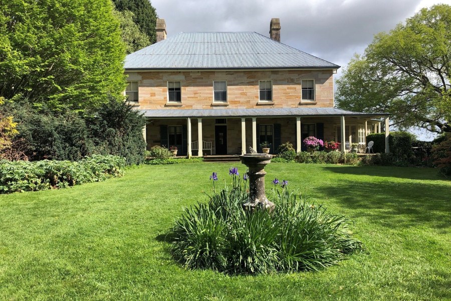
Ulster Park near Fitzroy Falls shows why a property needs more than one timeline. Society accounts connect the stone house with Peter Hart and describe later occupants, including the de Mestre family. Doug Cull bought the property in 1959 and wrote about restoring and farming it. His purchase date belongs on an ownership timeline; it does not establish the date of the earlier house.
Two Society newsletters give different construction years, 1881 and 1883. Record both statements and their references, and use the 1880s until further evidence resolves the difference. A researcher could identify the historical parcel, follow land records, and look for dated building notices, rate records, photographs and family papers. Respect the privacy of the present property and make arrangements before visiting.
A worked example
This example is fictional and illustrates a research method, not a real historical finding.
How old is a house on a changing street?
Suppose a house is now numbered 12, but an old directory has no street numbers. Identify its present parcel, then compare historical subdivision plans and maps with street names and neighbouring properties. Record each plan’s date and reference.
Build separate timelines for land ownership, possible occupants and the building itself. A dated photograph or a contemporary building notice may help narrow the construction period; a land transaction alone does not prove when the house was built.
Follow a builder through the records
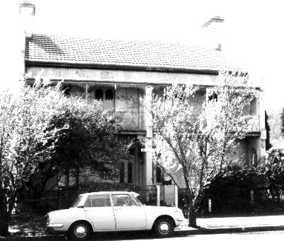
Research into Bowral terraces led the Society’s Linda Emery to builder Charles Grove and his sons. Her account links land and mortgage records with an 1886 newspaper advertisement offering the Merrigang Street terraces for rent. That advertisement is evidence the houses were complete by then; it is a useful example of how a dated notice can help establish a building’s history.
After the Society published the Grove story, a family member contacted the archives about the buildings and the family’s connection to them. The Society’s article also records Grove’s work on the ES&A Bank at Burrawang. Research can begin with a single house and lead to a much wider network of people and places.
Read the Grove house history · Read the family’s response
Useful resources
- Trove - Notices, reports, advertisements, people and place context.
- Museums of History NSW / State Archives family-history guide - Convicts, assisted immigrants, probate, schools, land and NSW government records.
- NSW Historical Land Records Viewer - Parcel history, subdivisions, historic titles and parish/town maps.
- NSW Spatial Services historical/parish maps - Parish, county, town and historic map context.
- Wingecarribee Public Libraries Local Studies - Local newspapers, photos, rate books, cemetery registers and council material.
- Wingecarribee Shire Council Heritage - Heritage listings, conservation areas and studies.
- State Library of NSW Pictures Collections - Historic photographs, artworks, landscapes and documentary images.
- Historic photographs
- Historic maps and plans
- Town histories
- Explore Yarrunga and Ulster Park
- Explore Avoca district history
Explore the full research resource directory · Search the Society library catalogue · Browse Society newsletters
Let the Society help with your research
The Society can undertake professional research at $40 per hour. Tell us what you would like to discover, what you already know and any records you have checked. Contact the research centre to discuss your question and request a quote before work begins.
Email [email protected] or call (02) 4872 2169.
Common questions
Does a heritage listing tell me who lived there?
Not usually. It can be an excellent lead, but needs corroboration from title, rate, directory, electoral, newspaper or archival evidence.
Can a map prove the building date?
A map may show a structure by its survey or publication date; compare it with other evidence before stating a construction date.