Discover Mount Murray
A farming and railway locality near Robertson, with a school history preserved in the Society’s library and traces within the Upper Nepean catchment.
Explore nearby and connected places: Robertson · Kangaloon · East Kangaloon · Burrawang
Mount Murray through time
Farms, timber and schooling
Mount Murray sits east of Robertson, in a landscape connected with Kangaloon, the upper Nepean and the escarpment. The National Parks and Wildlife Service describes the Kangaloon area around Mount Murray as a dairying and potato-growing district from about the 1860s. The story is part of the wider clearing and settlement of the Yarrawa Brush, and should also be understood in the context of the continuing histories of the First Peoples of this country.[5]
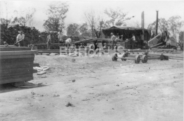
Timber work was part of the district’s rural economy. Philip Morton’s Society account says Thomas Seery and John Hayter moved their sawmill from East Kangaloon to a Mount Murray forest in 1894; it operated there until a bushfire destroyed it in 1905. The article draws on contemporary newspaper reports and connects the mill to families and enterprises across the eastern Highlands.[10]
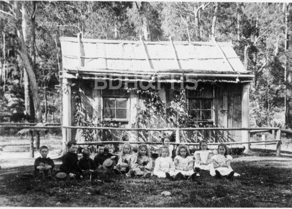
Schooling linked families across the rural district. The NSW Department of Education’s historical dataset lists a provisional school from August 1872, called Garretts Flat until March 1875, and several later provisional and public-school periods. Its last listed period ends in July 1943. The Society’s catalogue lists James Revis Fairbairn’s Mount Murray School 1873-1947, so the date range in that title differs from the administrative record; original school files may explain the difference. An 1889 parliamentary roads paper refers to a road from Robertson to the school.[9][7][8]
The Upper Nepean conservation plan records the site of the former school and other former farms in the catchment. It says that buildings in the special area were demolished following land resumption by the water authority and may now survive only as archaeological sites. The administrative record’s final school period ends in 1943; further sources are needed to explain its difference from the Society catalogue’s book title. Catchment restrictions must be respected; consult current access rules before visiting.[5][9][7]
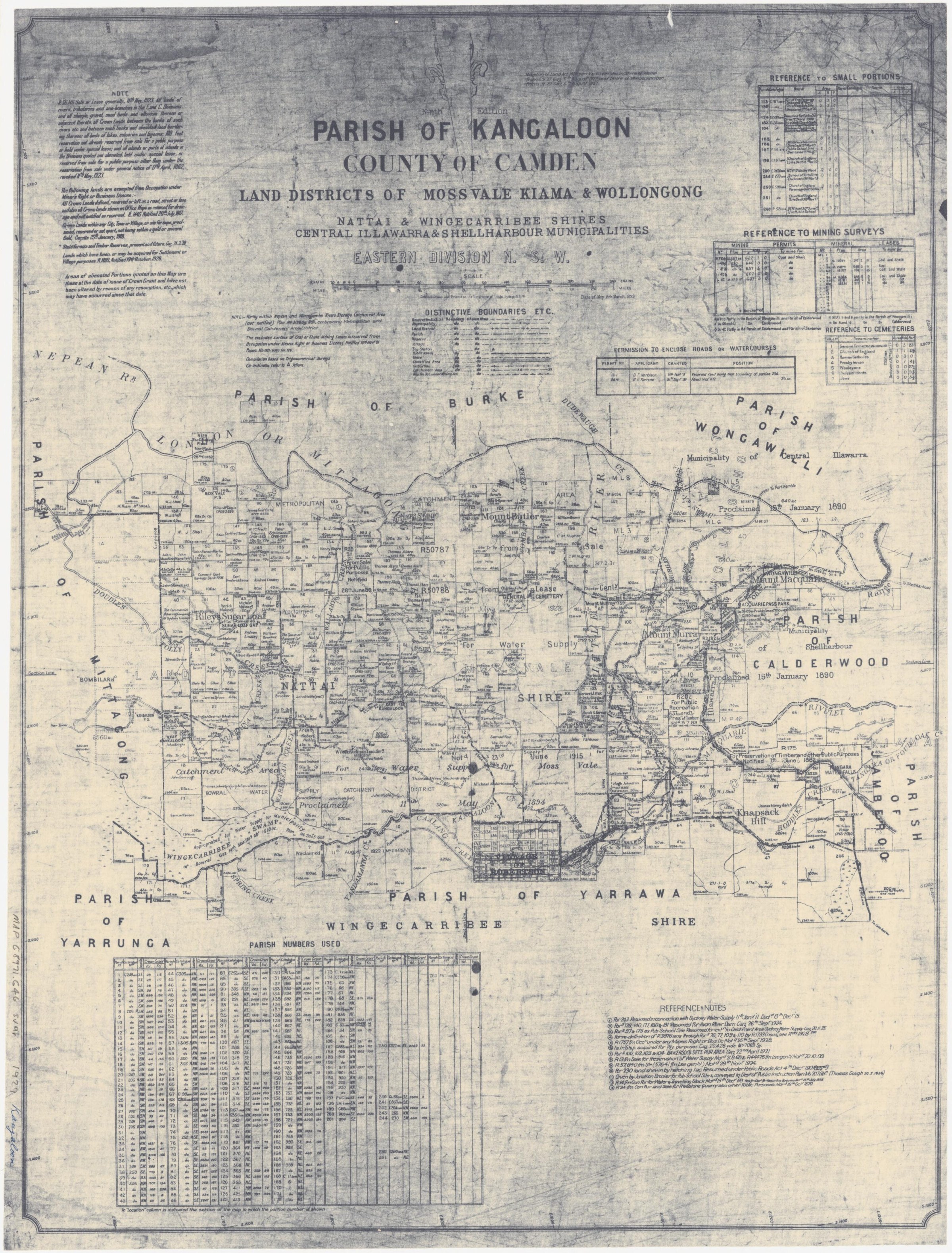
Railway and parish map
The 1932 Mount Murray railway station group includes a small timber wayside station and a precast-concrete platform, according to Heritage NSW. The Moss Vale-Unanderra line linked the highlands and the coast; the station survives as evidence of small railway facilities. Railway land is not necessarily open to the public.[6]
The 1929 Parish of Kangaloon map places Mount Murray within a landscape of numbered land portions, roads, streams and water-supply reservations. The edition predates the 1932 railway station, though annotations on surviving copies may be later; individual boundaries and dates require comparison with survey and title records.[11]
Related historical names and search terms: Mt Murray, Mount Murray School. These may name a former settlement, institution or nearby feature; check the context in the sources.
Browse local photographs linked to Mount Murray
Explore the Society’s photographs for sale
Browse maps and plans linked to Mount Murray
Explore the newsletters
Search newsletter contents for Mount Murray. You can also try nearby places, former names and other spellings.
Books in our Library
These catalogue titles mention Mount Murray. Check the linked catalogue and ask the Society about access.
- Kangaloon Footprints: A Collection of Records, Photographs and Anecdotes of Kangaloon, East Kangaloon, Mount Murray a (2013) - catalogue p. 38 Local recorded events, photographs, charts and anecdotes about Kangaloon and its district. Description source
- Mount Murray School 1873-1947 - catalogue p. 44 A local school history. The dates are part of the catalogue title and should be checked against original school records before treating them as verified opening and closing dates. Description source
- Mount Murray School Records (2 folders) - catalogue p. 44 Two folders of school records are listed in the Society’s catalogue. Ask the Society about their contents and access. Description source
Further research
There is more to discover about Mount Murray in the Society’s archives and in other collections. A catalogue entry may lead to material that has not been digitised or needs to be consulted in person.
- Ask the Society’s research centre about local files, photographs and records.
- State Library of NSW collections - search photographs, maps, manuscripts and local publications.
- NSW Historical Land Records Viewer - search historical land records, plans and parish maps by place or parcel.
Sources already connected with this place include:
- NSW National Parks and Wildlife Service: Upper Nepean State Conservation Area plan, historic heritage
- Heritage NSW: Mount Murray Railway Station group
- NSW Parliament: subordinate roads paper, 1889
- NSW Department of Education historical school records: Mount Murray
The Society can undertake professional research at $40 per hour. Contact the research centre to discuss your question and request a quote.