Discover Goodmans Ford
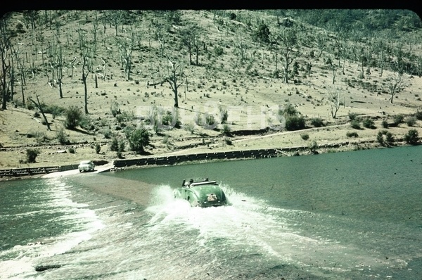
A Wollondilly River crossing on the historic road between the Highlands and Wombeyan Caves.
Explore nearby and connected places: Bullio · High Range · Wombeyan Caves · Mittagong · Canyonleigh
Goodmans Ford through time
Road and river crossing
Goodmans Ford is a locality and crossing of the Wollondilly River on Wombeyan Caves Road. The road links Mittagong and the Highlands with the Wombeyan Caves district across difficult ridges and valleys. The river crossing is one part of that route; Bullio and the sandstone tunnel lie on the Highlands side, while the road continues west toward the caves.[3][6]
Council’s 1991 heritage study places the crossing in the development of the Wombeyan road and dates the Goodmans Ford bridge to 1967. The study also records work on the road down to the Wollondilly around 1901. Earlier travellers crossed this country before the later bridge: in a 1940 Sydney Bush Walkers account, a walker recalled arranging a car from Goodmans Ford back to Moss Vale after a journey along the river. The account is one traveller’s experience rather than a complete transport history.[3]
In May 1924 a Barrallier correspondent reported progress on a cement causeway at Goodmans Ford and increasing motor traffic on the caves road. Three years later a local paper reported a sports meeting for road workers there, with swimming, running and a tug of war as work on that section neared completion. These reports show both construction and the people working along the route; they do not establish the later bridge’s construction date.[7][8]
The crossing today
The river and the road are closely connected. A NSW fisheries study describes work at the Goodmans Ford crossing to reduce sediment entering the Wollondilly, including drainage and retention measures on the approaches. It is a reminder that a route through the landscape also affects the waterway and the habitat downstream.[5]
Road and weather conditions can change quickly. Council describes Wombeyan Caves Road as a historic tourism route with narrow unsealed sections and provides current project and access information. Check Council and National Parks notices before travelling; its advice identifies Taralga Road as the primary route to the caves and the section beyond Goodmans Ford as a secondary route for suitable four-wheel-drive vehicles.[6]
Related historical names and search terms: Goodman’s Ford. These may name a former settlement, institution or nearby feature; check the context in the sources.
Explore the Society’s photographs for sale
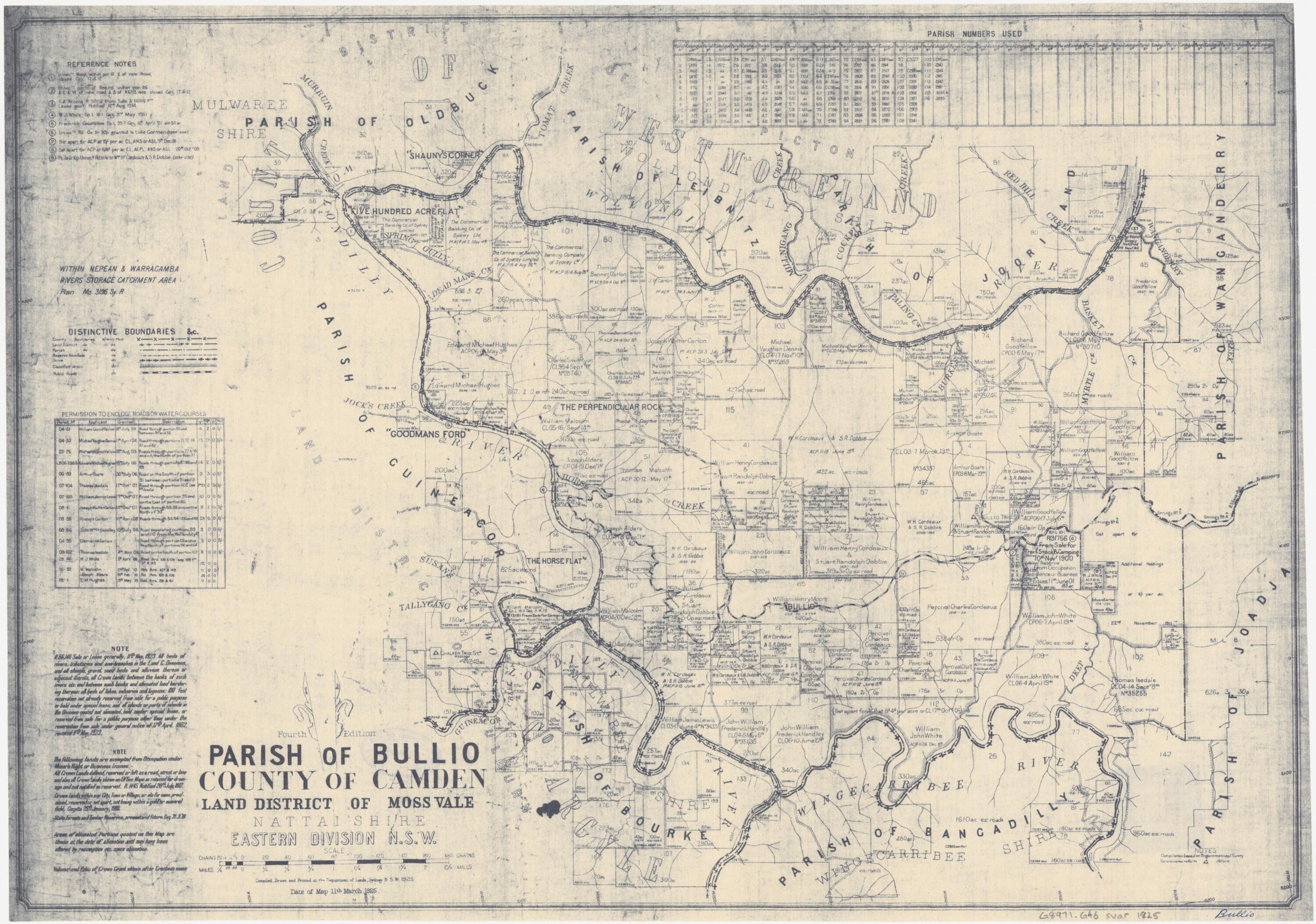
Browse maps and plans linked to Goodmans Ford
Explore the newsletters
Search newsletter contents for Goodmans Ford. You can also try nearby places, former names and other spellings.
Further research
There is more to discover about Goodmans Ford in the Society’s archives and in other collections. A catalogue entry may lead to material that has not been digitised or needs to be consulted in person.
- Ask the Society’s research centre about local files, photographs and records.
- State Library of NSW collections - search photographs, maps, manuscripts and local publications.
- NSW Historical Land Records Viewer - search historical land records, plans and parish maps by place or parcel.
Sources already connected with this place include:
- Wingecarribee Heritage Study 1991: Wombeyan road and Goodmans Ford bridge
- NSW fisheries: reducing impacts of road crossings on aquatic habitat
- Wingecarribee Council: Wombeyan Caves Road works and travel advice
- Southern Mail, 6 December 1927: road workers’ sports at Goodmans Ford
The Society can undertake professional research at $40 per hour. Contact the research centre to discuss your question and request a quote.