Discover Penrose
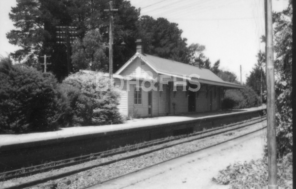
Penrose emerged beside the Main Southern Railway, later becoming an orchard and timber-milling village.
Explore nearby and connected places: Bundanoon · Exeter · Wingello · Belanglo
Penrose through time
An old road and a railway village
Old Argyle Road is part of a much older route through the Penrose landscape. A 2021 Society article draws on Bob Raymount’s Great South Road research and Heritage NSW’s inventory to describe the track from the Sutton Forest area toward Bungonia, with a route passing through the Penrose and Wingello districts. It discusses a contemporary road-reserve proposal as it stood in 2021; the article should not be used as a statement of current access arrangements.[10]
The Society’s account places the old road in a network of early routes. Joseph Wild oversaw construction of the South Road from Picton towards Cookbundoon in 1819-20, with Charles Throsby in charge. From 1824 surveyor William Harper traced a branch towards Bungonia; much of that later route is now known as Old Argyle Road. The article’s map and source references help distinguish the branch from Wild’s earlier line.[10]
A local historical guide records that the railway reached Marulan in 1868 and that Penrose developed shortly afterwards. The station was previously known as Cable’s Siding and stood further south; the guide places its move to the present village site in 1916. The older name and location are useful when searching railway and land records.[5]
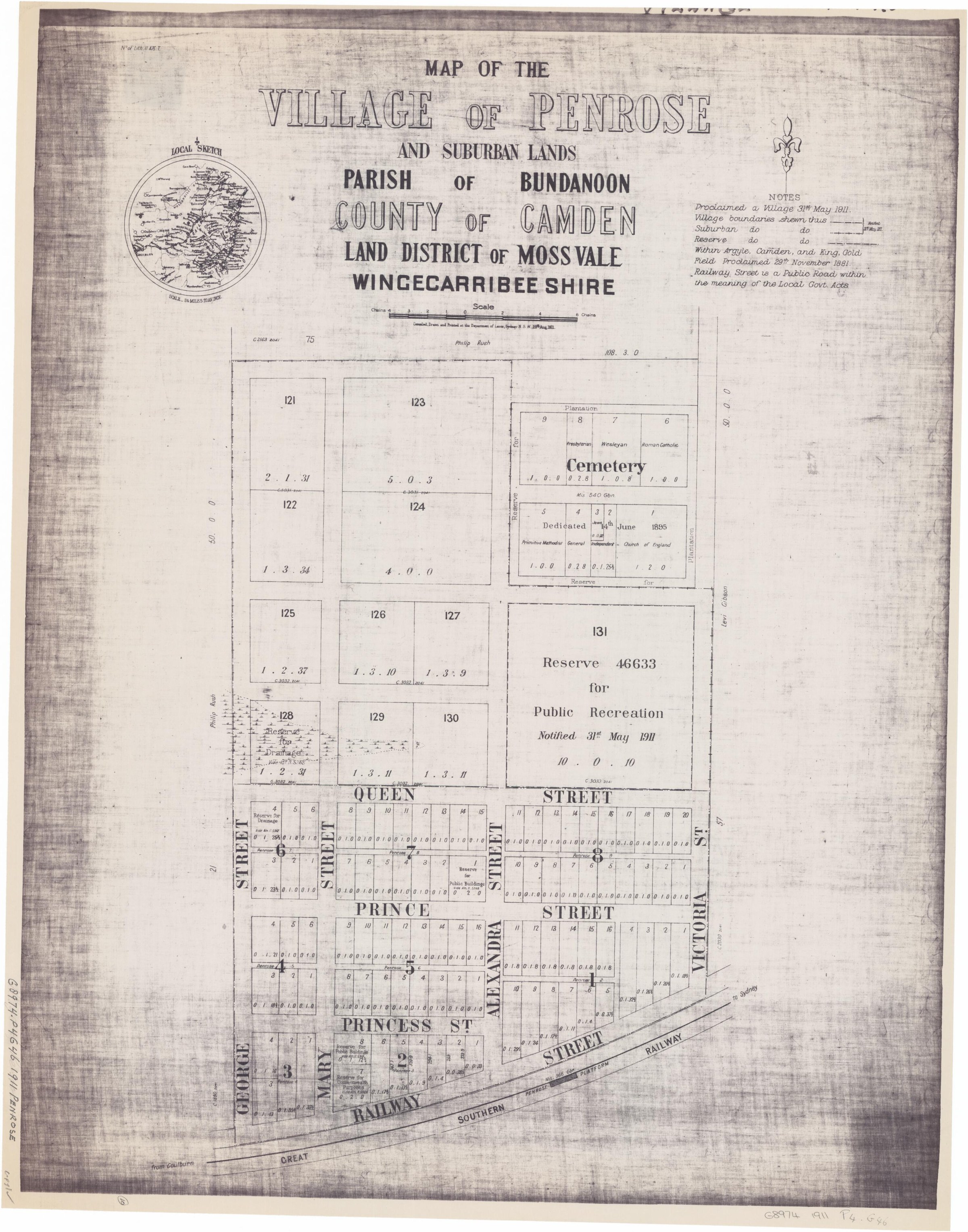
The 1911 Department of Lands village plan gives Penrose a clear historical footprint: numbered town allotments beside Railway Street and the station, larger suburban portions, a recreation reserve and a cemetery divided into denominational sections. The map records the layout and reserves shown at the time; land titles and later plans are needed to trace sales and occupation.[11][12]
The orchard years
Penrose became an orchard town in the early twentieth century, attracting growers and visitors until the last productive roadside orchard closed in the late 1980s. The same guide dates Penrose Pine Products from 1939. Forestry Corporation records the wider southern-highlands pine industry: radiata pines were first planted at nearby Belanglo in 1919, with commercial plantations and local timber processing continuing in the region.[6]
A Bundanoon community history recalls more than 500 acres of orchards in the 1920s and a growers’ cooperative packing shed close to the railway goods yards. It also remembers guesthouses, tea rooms and Sunday school picnics. These recollections point towards railway freight records, cooperative papers, photographs and newspaper advertisements for a fuller account.[8]
Keith McMenomy’s Picturing Penrose: A hamlet in the Southern Highlands 1911-2011 brings local photographs together as a guide to the village’s history. The Society newsletter introduces the author and his 2013 book.[7]
For photographs, the Bundanoon History Group’s published archive catalogue lists two Penrose apple-orchard photographs dated 1961, references P.1471 and P.1471a. The catalogue is a lead to the holding, not permission to reproduce the images; contact the group for access and reuse conditions.[9]
Related historical names and search terms: Cable’s Siding. These may name a former settlement, institution or nearby feature; check the context in the sources.
Browse local photographs linked to Penrose
Explore the Society’s photographs for sale
Read the landscape
1837
View the annotated map on page 6 of the linked newsletter.
Early southern roads: annotated extract of an 1837 NSW map
The Society article overlays colours on an extract it dates to 1837 to compare early roads and the track towards Bungonia. It is a regional view, not a detailed village plan; verify the map’s original identity and the routes against contemporary surveys.
Related places: Penrose, Bundanoon, Sutton Forest
Map extract reproduced and annotated in Society newsletter 542, October 2021, p.6; original map and later annotations need separate attribution.
View in the Society newsletter; identify the original map and annotation rights before extracting or reproducing it.
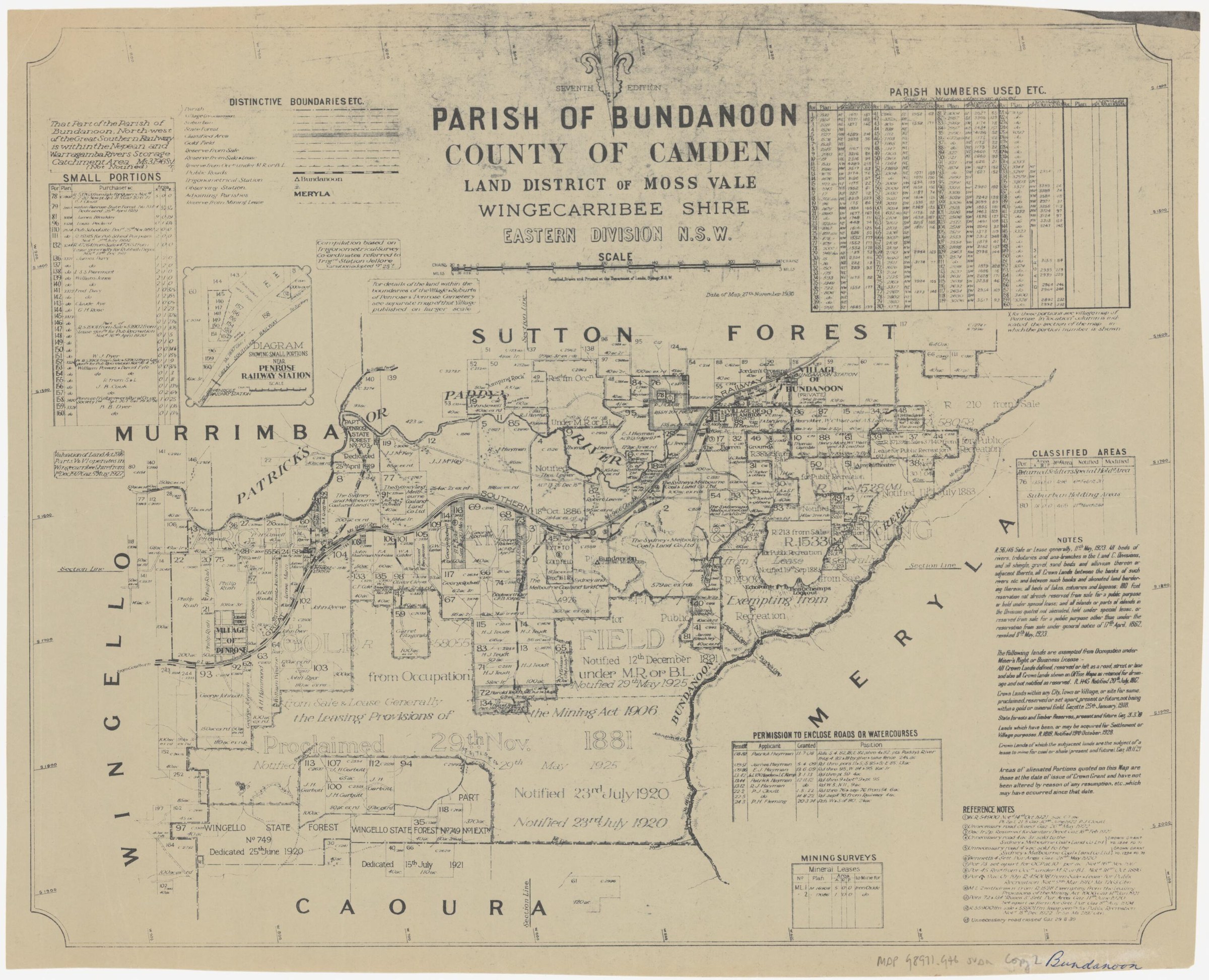
Browse maps and plans linked to Penrose
Newsletter Mentions
Stories about Penrose in the Society’s newsletters.
August 2018
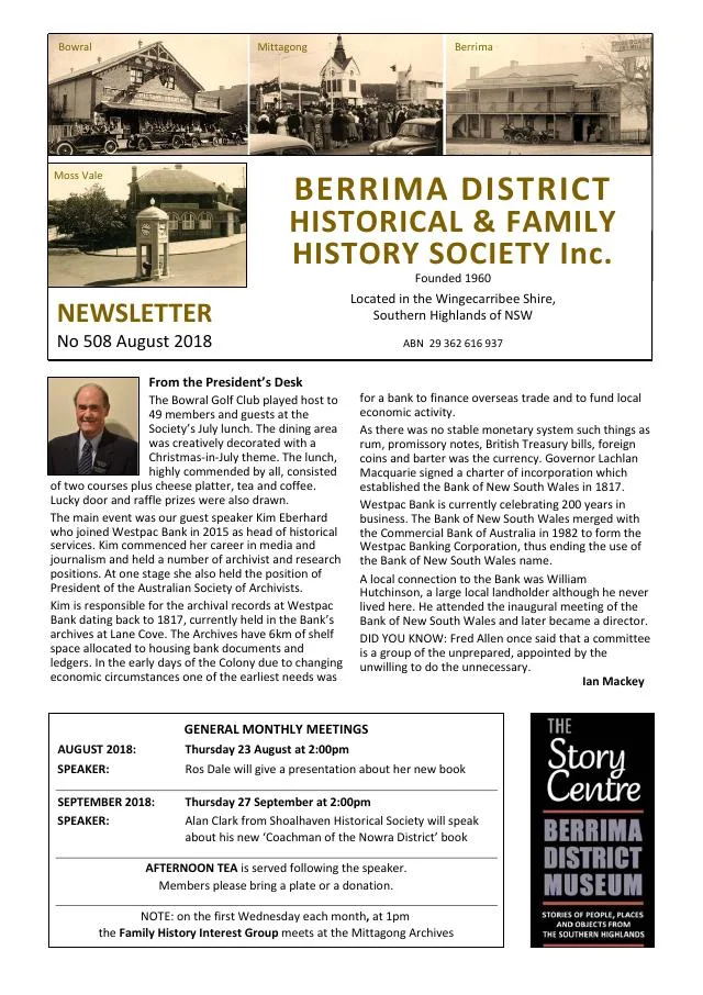
- The Society marks 150 years of the Moss Vale-Marulan railway, which served the later villages of Exeter, Bundanoon, Penrose, Wingello and Tallong (p.3).
March 2014
- The issue introduces Keith McMenomy’s Picturing Penrose and a Society tour of Joadja (p.3).
January 2014
- New local histories introduce Penrose, Berrima and Kangaloon; the issue explains historical Kangaloon and West Kangaloon naming (p.7).
Books in our Library
These catalogue titles mention Penrose. Check the linked catalogue and ask the Society about access.
- A Village called Penrose. (1987) - catalogue p. 7
- Penrose Public School - catalogue p. 48
- Penrose School's Centenary Cook Book - catalogue p. 48
- Picturing Penrose: A hamlet in the Southern Highlands 1911-2011. (2013) - catalogue p. 49 A local pictorial history of Penrose; the Society newsletter introduces the author and the book. Description source
- The research of Eric William Cupitt: Eliza Bupitt, Descendants of James Cupitt and Bridget Penrose, Descendants of August (2008) - catalogue p. 69
Find Society publications mentioning Penrose. The list is from October 2026; contact the Society about current availability.
Further research
There is more to discover about Penrose in the Society’s archives and in other collections. A catalogue entry may lead to material that has not been digitised or needs to be consulted in person.
- Ask the Society’s research centre about local files, photographs and records.
- State Library of NSW collections - search photographs, maps, manuscripts and local publications.
- NSW Historical Land Records Viewer - search historical land records, plans and parish maps by place or parcel.
Sources already connected with this place include:
- Map of the village of Penrose and suburban lands, Parish of Bundanoon, 1911, National Library of Australia
- Parish of Bundanoon, seventh edition, 1930, National Library of Australia
The Society can undertake professional research at $40 per hour. Contact the research centre to discuss your question and request a quote.