The Southern Highlands is a landscape of towns, villages, farms, bushland and waterways. Explore the map, then follow the stories of the places that grew here.
The district today
Map data © OpenStreetMap contributors. Select a town marker to open its story. Town locations are from Geoscience Australia’s Composite Gazetteer; the map background requires an internet connection.
For the council’s official locality boundaries and the relationship between neighbouring places, open Wingecarribee Shire Council’s map. The council map is maintained by Wingecarribee Shire Council.
The story of the Southern Highlands
Country before the colonial record
Long before roads and towns crossed the Highlands, Aboriginal people knew and cared for these waterways, forests and open country. Wingecarribee Shire Council acknowledges Gundungurra and Dharawal people as the traditional custodians of the land within the shire; their connections to Country continue today.[2]
Exploration, roads and the first colonial crossings
Council dates the first European exploration of the area to 1798. In 1817 Charles Throsby explored near Moss Vale and Sutton Forest. These journeys redirected colonial attention through Country that Aboriginal people already knew in detail; the later roads and settlements should be understood as part of that dispossessing expansion, not as the beginning of the landscape’s history.[2][3]
A new road and planned settlements
The difficult earlier route across the Mittagong Range was replaced by a western alignment in the 1830s. Berrima was surveyed on that route in 1831, after Surveyor-General Thomas Mitchell identified the site while planning the new road. Coach traffic, inns, the courthouse and gaol made Berrima the colonial administrative focus, while Nattai supplied another foundation for the later town of Mittagong.[2][4]
Railway towns reshape the district
Rail construction brought camps, speculative town allotments and new stations. The Main Southern Railway opened to Bowral and Moss Vale in December 1867 and then to Goulburn in 1869. It drew commerce and settlement toward stations at Mittagong, Bowral and Moss Vale, while the line's bypass of Berrima helped leave that older road town unusually intact.[2][5]
A landscape of work, villages and heritage
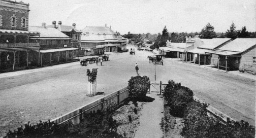
By the late nineteenth century, railway stations, farms and villages had become part of a changing landscape. At Joadja, miners and their families built a shale-oil town in the valley; elsewhere dairies, orchards, quarries and workshops supported growing communities. Visitors came for the mountain air and scenery, and the old road towns and newer railway centres became places in which to live, work and remember.[2]