Discover Wildes Meadow
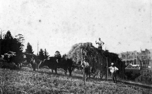
Wildes Meadow developed within the Yarrawa Brush district and its swampy valley was drained for farmland in 1880.
The 2021 Census counted 249 people in Wildes Meadow.[24]
Explore nearby and connected places: Robertson · Burrawang · Kangaloon
Wildes Meadow through time
Early selection and a farming valley
A Council planning record, drawing on district history, describes the route explored south from Bong Bong through the land where Burrawang stands and across the swampy valley later drained in 1880 to become Wildes Meadow farmland. The locality’s history is therefore bound to rainforest clearing, drainage and agricultural settlement alongside Robertson and Burrawang.[9][10]
Family accounts offer another way into the settlement’s history. In 2010 Society member Bruce Moore described an ancestor coming up from Jamberoo and selecting land at Wildes Meadow in 1862, with succeeding generations born on the farm. Treat this as a family-history lead to be checked against land and registration records.[11]
Linda Emery’s research into the sandstone Protestant Hall links a surviving building to the early land-selection system. Edward Moses selected 150 acres in 1862, recorded as Portion 31 in the Parish of Yarrawa; the hall was completed on his land in 1874 for the local Loyal Orange Lodge. Her article follows the property into a 1926 survey and deposited plan 317716, and identifies newspaper and Crown grant sources for further research.[17]
A later Society profile connects the Mackey family with the village. It records that John Mackey and Mary Ann Delanty moved from Tasmania to NSW around 1868 with their children and settled at Wildes Meadow, where John farmed; their descendant Ian Mackey later became Society president. This brief family account provides names and a chronology to check against land and registration records.[18]
An 1881 livestock and land report provides a snapshot of farm values and local dairying. Agent David Moffitt reported selling Isaac Stewart’s 64-acre Wildes Meadow farm at £13 2s 6d an acre, describing it as well improved; he also listed sales of dairy herds in Burrawang and West Kangaloon. This is a contemporary agent’s report of particular transactions, not a general valuation of the district.[19]
A school and a dairying district
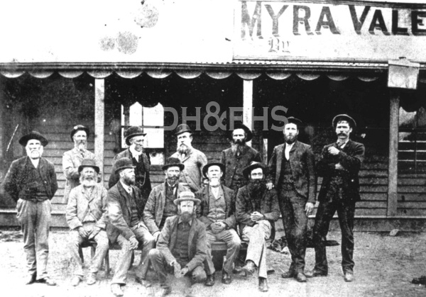
The school’s names tell a similar story but need to be followed precisely. The NSW Department of Education records Myra Vale Public School from October 1877 to May 1968, with the earlier names Burrawang East until February 1885 and Wildes Meadow until October 1893. The Society’s Yarrunga admissions index also includes families recorded as living at Myra Vale, so both school collections may help a researcher locate a family.[14][16]
Council’s community heritage evidence reproduces Linda Emery’s account of the small settlement known as Myra Vale. It describes a Methodist church built in 1874 and, by around 1900, a hotel, stores and other services serving a dairying district. The account places the school building in 1879; the education dataset records the school’s operation from 1877, so the building date and opening date should not be treated as the same event without further evidence.[15]
Names changed in local usage. A historical newspaper extract reproduced in the Society’s September 2014 newsletter discusses the spellings Wild’s and Wilde’s Meadow and recalls a period when the district was called Myra Vale. Search these variants when tracing families or local institutions, and check the original date and context of each record.[12]
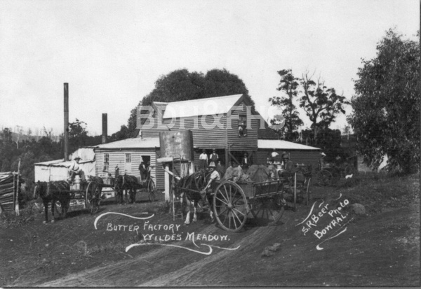
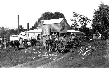
Dairying shaped the valley’s working life. A Society history dates the Emu butter factory at Wildes Meadow to 1889, part of a network of small cooperative factories. Farmers brought whole milk in cans; after the cream was separated, skim milk returned to farms for livestock. The Society newsletter reproduces a photograph of the factory and horse-drawn carts.[13]
Neighbouring communities worked together on a memorial project after the First World War. In November 1921 The Scrutineer reported a meeting at Burrawang School of Arts representing Burrawang, Wildes Meadow and Avoca. The meeting formed a committee and planned a concert and dance to support a proposed soldiers’ memorial hall at Moss Vale; the report records the plan rather than its outcome.[22]
The district’s dairies also supplied a wider network. Reporting the opening of the Dairy Farmers’ Co-operative Milk Company factory at Moss Vale in September 1922, The Daily Telegraph named Avoca, Wildes Meadow, Yarrunga, Burrawang, Robertson and Manchester Square among the districts from which milk would be drawn. The plant was intended to produce butter and pasteurised milk for Sydney.[23]
Church and community in later years
The church’s history also includes the work of its congregation. Elnor Bruem’s 1983 account describes the women’s fellowship beginning as a church aid group in 1953, raising funds through garden parties, tennis, coffee mornings and combined fetes, and closing in 1983. Her account names members and ministers and records links with Robertson and Moss Vale congregations, offering leads into community life beyond the building itself.[20]
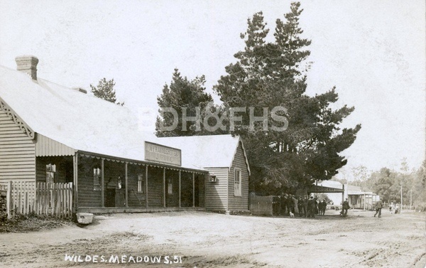
Related historical names and search terms: Myra Vale, Wild's Meadow, Wilde's Meadow. These may name a former settlement, institution or nearby feature; check the context in the sources.
More views of Wildes Meadow
Select a thumbnail to see the larger image. Captions and credits follow the available source records.
Browse local photographs linked to Wildes Meadow
Explore the Society’s photographs for sale
Read the landscape
1887
Find call number Z/CP/C1/118 in the linked State Library list.
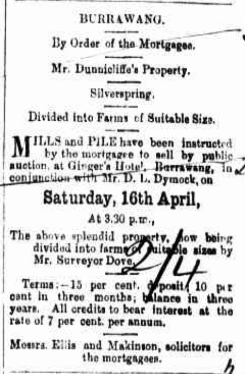
Silverspring, Burrawang: subdivision plan
The library lists a Silverspring, Burrawang subdivision plan dated for auction on 16 April 1887 and identifies Wilds Meadows Road as a boundary. This is a separate catalogue entry from the Barrett brothers’ 1889 auction; the list does not establish that it is the same land.
Related places: Burrawang, Wildes Meadow
State Library of New South Wales, Camden County subdivision plans, Z/CP/C1/118.
The link leads to a catalogue list, not a verified image of the plan; check the individual item and reuse conditions before reproducing it.
Browse maps and plans linked to Wildes Meadow
Newsletter Mentions
Stories about Wildes Meadow in the Society’s newsletters.
September 2014
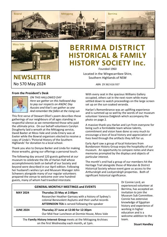
- The issue recalls the 1929 electricity connection to Bundanoon and Exeter and reproduces a 1929 discussion of the name Wildes Meadow (pp.6-7).
March 2010
- An 1881 stock and land report lists dairy sales and a Wildes Meadow farm transaction (p.2).
Further research
There is more to discover about Wildes Meadow in the Society’s archives and in other collections. A catalogue entry may lead to material that has not been digitised or needs to be consulted in person.
- Ask the Society’s research centre about local files, photographs and records.
- State Library of NSW collections - search photographs, maps, manuscripts and local publications.
- NSW Historical Land Records Viewer - search historical land records, plans and parish maps by place or parcel.
Sources already connected with this place include:
- Wingecarribee planning record
- Council heritage-study planning proposal
- NSW Department of Education: Myra Vale school and earlier names
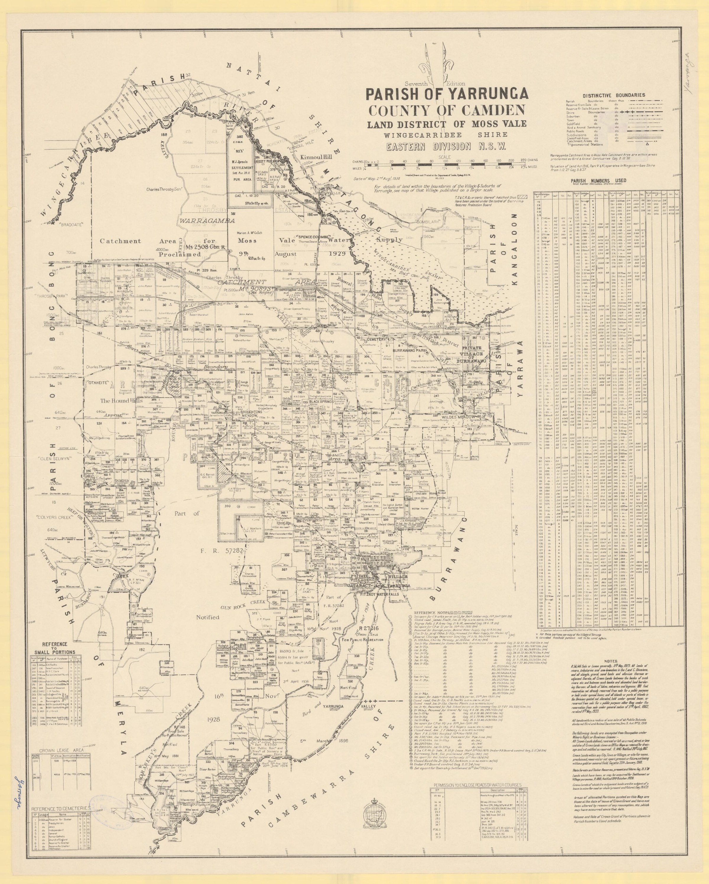
- Parish of Yarrunga, seventh edition, 1938, National Library of Australia
The Society can undertake professional research at $40 per hour. Contact the research centre to discuss your question and request a quote.